

About the NWS
National Program
Weather Satellites are an important observational tool for all scales of NWS forecasting operations. Satellite data, having a global view, complements land-based systems such as radiosondes, weather radars, and surface observing systems.
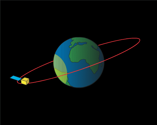
There are two types of weather satellites: polar orbiting and geostationary. Both satellite systems have unique characteristics and produce very different products.The two polar orbiting satellites, in their north-south orbits, observe the same spot on the Earth twice daily, once during the daylight and once at night. Polar orbiting satellites provide imagery and atmospheric soundings of temperature and moisture data over the entire Earth. Geostationary satellites are in orbit 22,000 miles above the equator, spin at the same rate of the Earth and constantly focus on the same area. This enables the satellite to take a picture of the Earth, at the same location, every 30 minutes. Computer processing of this data creates “movie loops” of the data that forecasters use as their real-time “bird’s eye view” from space.
|
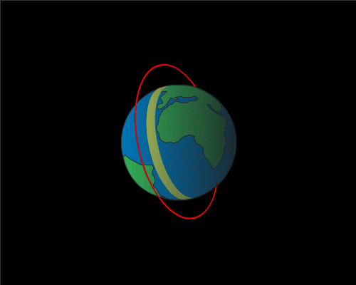 |
| The East-West orbit of GOES satellites depicted in the yellow circle. | The North-South orbit of Polar orbiting satellites depicted in the yellow line. |
The two US geostationary satellites provide imagery over North and South America and the Atlantic and Pacific oceans. During severe weather outbreaks, the geostationary satellites can be commanded to take images every 5- 15 minutes, and will focus in on smaller impacted area. On very special occasions the geostationary satellites can be commanded to take a picture every minute, but of a very small area like a severe thunderstorm. Geostationary satellites can also take atmospheric profiles of temperature and moisture, but at a reduced resolution compared to polar satellites and radiosonde soundings.
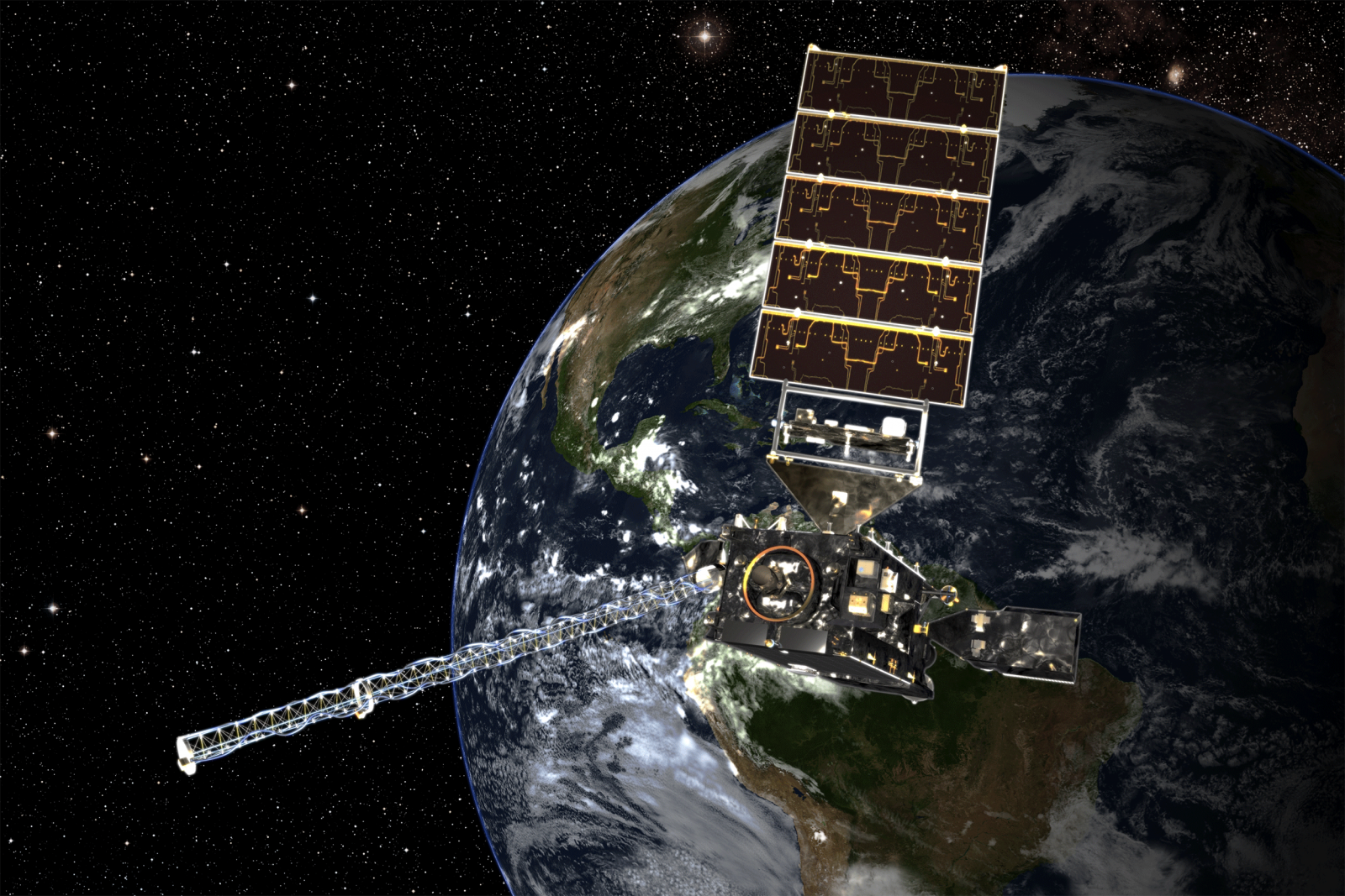
NOAA newest geostationary weather satellites, GOES-16 was successfully launched on November 19, 2016. When operational, GOES-16 will provide continuous imagery and atmospheric measurements of Earth’s Western Hemisphere, total lightning data, and space weather monitoring to provide critical atmospheric, hydrologic, oceanic, climatic, solar and space data.
GOES-16’s environmental data products, expected to be operational by late 2017, will support short-term 1-2 day weather forecasts and severe storm watches and warnings, maritime forecasts, seasonal predictions, drought outlooks and space weather predictions.
-
GOES-16 will offer 3x more types of imagery with 4x greater resolution, and available 5x faster than ever before.
-
GOES-16 can multi-task. The satellite will scan the Western Hemisphere every 15 minutes, the Continental U.S. every five minutes, and areas of severe weather every 30-60 seconds, all at the same time.
-
GOES-16 can provide images of severe weather as frequently as every 30 seconds!
-
The satellite’s revolutionary Geostationary Lightning Mapper (GLM) will be the first-ever operational lightning mapper flown from geostationary orbit.
For a more detailed description of the polar and geostationary satellites visit:
http://noaasis.noaa.gov/NOAASIS/ml/genlsatl.html
To learn how Weather Satellites Imagery and Data products are used in NWS operations, visit:
https://www.nesdis.noaa.gov/content/how-our-data-are-used
 |
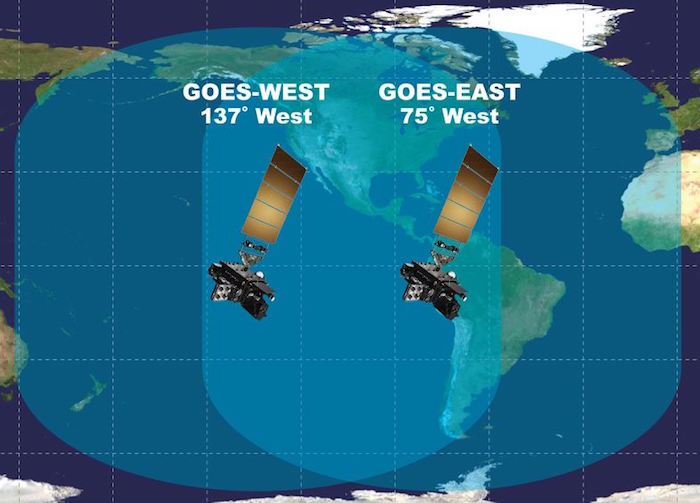 |
| NOAA’s GOES-16 from space | GOES orbit covering The Americas and the Atlantic and Pacific Oceans |